
Global Precipitation Measurement Satellite Successfully Launched By JAXA & NASA
@abrakadabra
•
Oct 14, 2024
Oct 14, 2024
1.4K
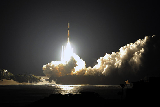
Japan and U.S. have declared the successful launch of a Global Precipitation Measurement (GPM) satellite on Feb 28, 2014. Aboard a H-2A Launch Vehicle No. 23, the rocket was successfully lifted from the Tanegashima Space Center in Kagoshima, Japan. This project was undertaken jointly by JAXA (Japan Aerospace Exploration Agency) and NASA as well as Mitsubishi Heavy Industries Ltd. to design GPM such that more accurate and frequent observation of tropical rainfall can be made.
To understand the need for this satellite we have to know that the 21st century is often called "the century of water". Earth has been facing problems related to this crucial resource in many parts. In some regions there are water shortages, while in others there are floods - resulting in food shortages, epidemic diseases etc. The global water cycle has been badly affected due to global warming and therefore we witness abnormal weather conditions - such as frequent heavy rains and droughts. As a solution to these pressing issues, researchers face the need to accurately determine the rainfall distribution, which is the input to water resources, so that improvements can be made to the techniques of predicting and preparing for abnormal weather.
Taking steps forward in this direction, Japan has been working with NASA to measure tropical and subtropical rainfall through #-Link-Snipped-#. The international satellite mission called 'GPM' will help these researchers in accurate and frequent observation of tropical rainfall by expanding its observing areas to higher latitudes. GPM consists of one core satellite and approx. eight constellation satellites. The core satellite carries a dual-frequency precipitation radar (DPR) and a microwave radiometer, and the constellation satellites carry microwave radiometers.
The GPM Core Observatory will carry the first space-borne Ku/Ka-band Dual-frequency Precipitation Radar (DPR) and a multi-channel GPM Microwave Imager (GMI), which covers a swath of 550 miles (885 km) with thirteen channels ranging in frequency from 10 GHz to 183 GHz. The GMI uses a set of frequencies that have been optimized over the past two decades to retrieve heavy, moderate and light precipitation using the polarization difference at each channel as an indicator of the optical thickness and water content.
With data inputs from the GPM satellite, researchers will better be able to determine how much it rains or snows around the world. The GPM mission shall help better understand the Earth's water and energy cycles, so that we are able to more accurately predict the occurrence of extreme natural disasters and take steps to avoid or survive through them.
Other International space agencies involved with the GPM mission are - Centre National d’Études Spatiales (CNES), the Indian Space Research Organization (ISRO), the National Oceanic and Atmospheric Administration (NOAA), the European Organization for the Exploitation of Meteorological Satellites (EUMETSAT) among others.
Source: #-Link-Snipped-# | #-Link-Snipped-#