
Citizen Scientists To Be Empowered By Drones To Map El Niño Flooding
@sahil-badani-fLJODY
•
Oct 26, 2024
Oct 26, 2024
2.0K
At Long Beach, California, the ordinary are doing the extraordinary. Residents are taking to the coastline to observe, record and help out experts with the developments of the El Niño. The El Niño is defined by prolonged warming in the Pacific Ocean sea surface temperature. It typically happens at irregular intervals of two to seven years, and lasts nine months to two years. The direct effects are the rise in surface pressure over the Indian Ocean, Indonesia and Australia; fall in air pressure over Tahiti and parts of the central and eastern Pacific Ocean; and weakening of the Walker circulation and trade winds in the south Pacific.
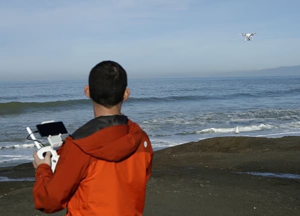
With a population of more than half a million, California is under persistent threat of El Niño-fueled storms. Climatologists at NASA’s Jet Propulsion Laboratory have already issued warnings that the beaches could become shorter or disappear altogether.
Now, The Nature Conservancy, an American charitable environmental organization, has requested tech freaks to capture the flooding and coastal erosion. And the residents are more than willing to take the onus upon themselves. Geotagging, a process of adding geographical identification metadata to various media, as well as crowd-sourcing, a modern business technique; are the two methods that could prove to be useful here.
To accomplish all this, latest drones are being looked at. These can produce high-definition 3D maps and enable scientists to figure out if predictive models about coastal changes are accurate. Lesley Ewing, senior coastal engineer with the California Coastal Commission regards this idea highly, as “a piece of the puzzleâ€.
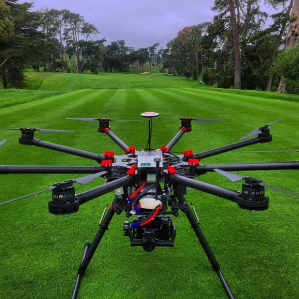
The Nature Conservancy is partnering with a San Francisco-based startup called DroneDeploy that will provide a free app to all drone owners. The app will provide automated flight patterns at the touch of a screen while cloud-based services will be used to manage the high amount of data.
Source: <a href="https://www.digitaltrends.com/photography/citizen-scientist-climate-change/" target="_blank" rel="nofollow noopener noreferrer">Citizen Scientists Document Climate With Drones | Digital Trends</a>
With a population of more than half a million, California is under persistent threat of El Niño-fueled storms. Climatologists at NASA’s Jet Propulsion Laboratory have already issued warnings that the beaches could become shorter or disappear altogether.
Now, The Nature Conservancy, an American charitable environmental organization, has requested tech freaks to capture the flooding and coastal erosion. And the residents are more than willing to take the onus upon themselves. Geotagging, a process of adding geographical identification metadata to various media, as well as crowd-sourcing, a modern business technique; are the two methods that could prove to be useful here.
To accomplish all this, latest drones are being looked at. These can produce high-definition 3D maps and enable scientists to figure out if predictive models about coastal changes are accurate. Lesley Ewing, senior coastal engineer with the California Coastal Commission regards this idea highly, as “a piece of the puzzleâ€.
The Nature Conservancy is partnering with a San Francisco-based startup called DroneDeploy that will provide a free app to all drone owners. The app will provide automated flight patterns at the touch of a screen while cloud-based services will be used to manage the high amount of data.
Source: <a href="https://www.digitaltrends.com/photography/citizen-scientist-climate-change/" target="_blank" rel="nofollow noopener noreferrer">Citizen Scientists Document Climate With Drones | Digital Trends</a>