Replies

Welcome, guest

Join CrazyEngineers to reply, ask questions, and participate in conversations.

CrazyEngineers powered by Jatra Community Platform

  • Dancer_Engineer

    @dancer-engineer-EJ8rGI • Feb 12, 2012

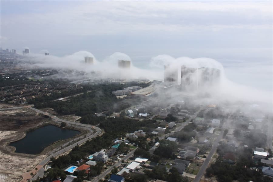
    Could someone throw light on how this effect occured? 😀

  • Anoop Kumar

    @anoop-kumar-GDGRCn • Feb 13, 2012

    Wow .. looking awesome


    In the last
    of article

    Meteorologist Dan Satterfield <a href="https://blogs.agu.org/wildwildscience/2012/02/06/condo-wave-clouds/" target="_blank" rel="nofollow noopener noreferrer">Fantastic Condo Wave Clouds - Dan's Wild Wild Science Journal - AGU Blogosphere</a>:
    Cool air offshore was very nearly at the saturation point, with a temperature near 20ºC and a dew point of about 19.5ºC. The air at this temperature can only hold a certain amount of water vapor, and how much it can hold depends heavily on the temperature. If you add more water into the air, a cloud will form, but you can also get a cloud to form by cooling the air. Drop the temperature, and it can no long hold as much water vapor, so some of it will condense out and a cloud will form.​

    I my view when saturated air entring into city .. due to heat got unsaturated and fog is not showing into city. This happen in winter season in Delhi some places are too foggy as compared to others. Seashore added magic to this phenomenon.