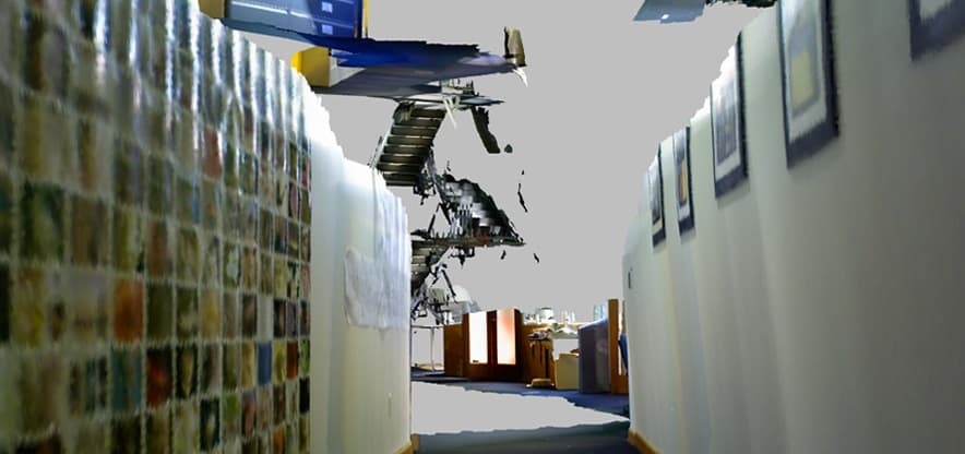
3D mapping algorithm creates detailed indoor & outdoor maps in real time
Engineers at MIT and National University of Ireland (NUI) have developed a 3D mapping algorithm that can create highly detailed indoor and outdoor 3D maps in real time. The research team used a regular Kinect camera and tested their algorithms to create rich, 3D maps of the MIT's Stata Center. The camera roamed through the halls and the stairways of the center and as soon as it reached the starting point - the algorithms quickly stitched all the photos it captured to create a rich 3D map. This technique, the researchers say, will solve a major problem in the robotic mapping community called 'loop closure' or 'drift'.

Image Credit: MIT
The new algorithm developed by the researchers is aware of the camera position in space while determining the route. The algorithm is capable of detecting when it's in the surroundings it's been before and begins creating 3D map almost in real time. Thomas Whelan, a PhD student from NUI who worked on the project says that the map itself gets tangled up in itself before it's corrected. The algorithms allow the maps to be shifted so that it wraps up into place.
This technique would be incredibly useful in creating rich and detailed maps of hazardous, unknown environments. For example, the technique would have been proved quite helpful at the Fukushima Nuclear Plant in Japan, where the humans couldn't enter the site because of the hazard of the radiations. This technique, combined with rescue robots would help recovery of humans from disaster sites.
Leonard, one of the students at MIT's Computer Science & AI laboratory says that with this technique, a new applicant at MIT would be able to 'swim' through MIT as if it's a big aquarium. The algorithms are continuously being evolved to make them more useful.
Read more about this development on the source link to MIT's news center.
Source: #-Link-Snipped-#

Image Credit: MIT
The new algorithm developed by the researchers is aware of the camera position in space while determining the route. The algorithm is capable of detecting when it's in the surroundings it's been before and begins creating 3D map almost in real time. Thomas Whelan, a PhD student from NUI who worked on the project says that the map itself gets tangled up in itself before it's corrected. The algorithms allow the maps to be shifted so that it wraps up into place.
This technique would be incredibly useful in creating rich and detailed maps of hazardous, unknown environments. For example, the technique would have been proved quite helpful at the Fukushima Nuclear Plant in Japan, where the humans couldn't enter the site because of the hazard of the radiations. This technique, combined with rescue robots would help recovery of humans from disaster sites.
Leonard, one of the students at MIT's Computer Science & AI laboratory says that with this technique, a new applicant at MIT would be able to 'swim' through MIT as if it's a big aquarium. The algorithms are continuously being evolved to make them more useful.
Source: #-Link-Snipped-#
0
